- SEE & DO
- EAT & DRINK
- STAY & VISIT
- EVENTS
- BUSINESS DIRECTORY
- MORE
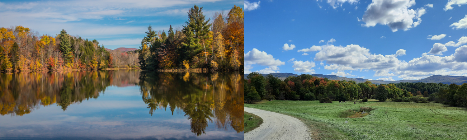
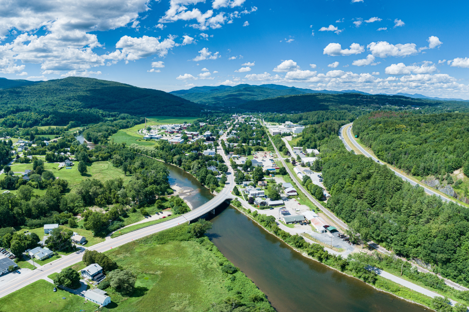
Vermont is undeniably a beautiful state, but add in the fall colors and it becomes a jaw-dropping, list-topping, must-visit destination. One of the best ways to explore the area is by winding along the waters and through the trees on a scenic drive. Stop and stretch your legs along the way, or just stick to the windshield tour. You can’t go wrong no matter how you decide to explore these vistas!
All driving distances and times listed below are approximate and calculated based on a one way trip. This information is only intended to guide you in selecting a scenic drive; be sure to consult maps and weather prior, as roads may be impassable at times due to mud or winter conditions.
Looking for a little more sightseeing in the area? Pair it with these other great self-guided tours!
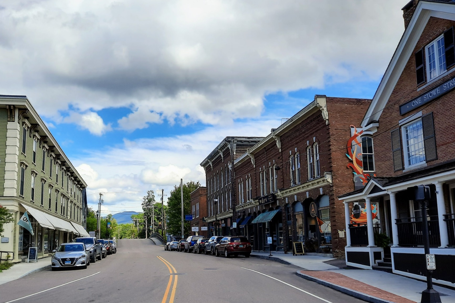 TOUR HISTORIC WATERBURY
Take a step back in time and explore Waterbury’s history. We invite you to meander down our back roads and side streets for beautiful vistas and interesting buildings, old and new.
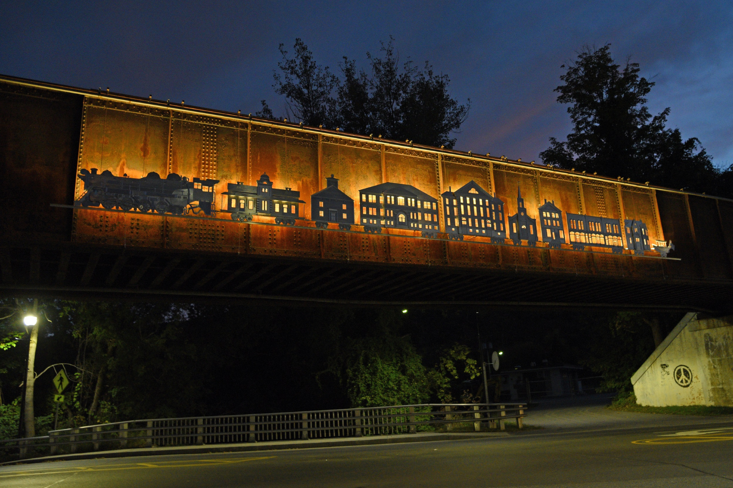 ENJOY WATERBURY'S PUBLIC ART
Waterbury has a myriad of public art, ranging from murals to miniatures, and sculptures to large-scale installations. The public art tour includes just a small sampling, so look high and low as you travel through town.
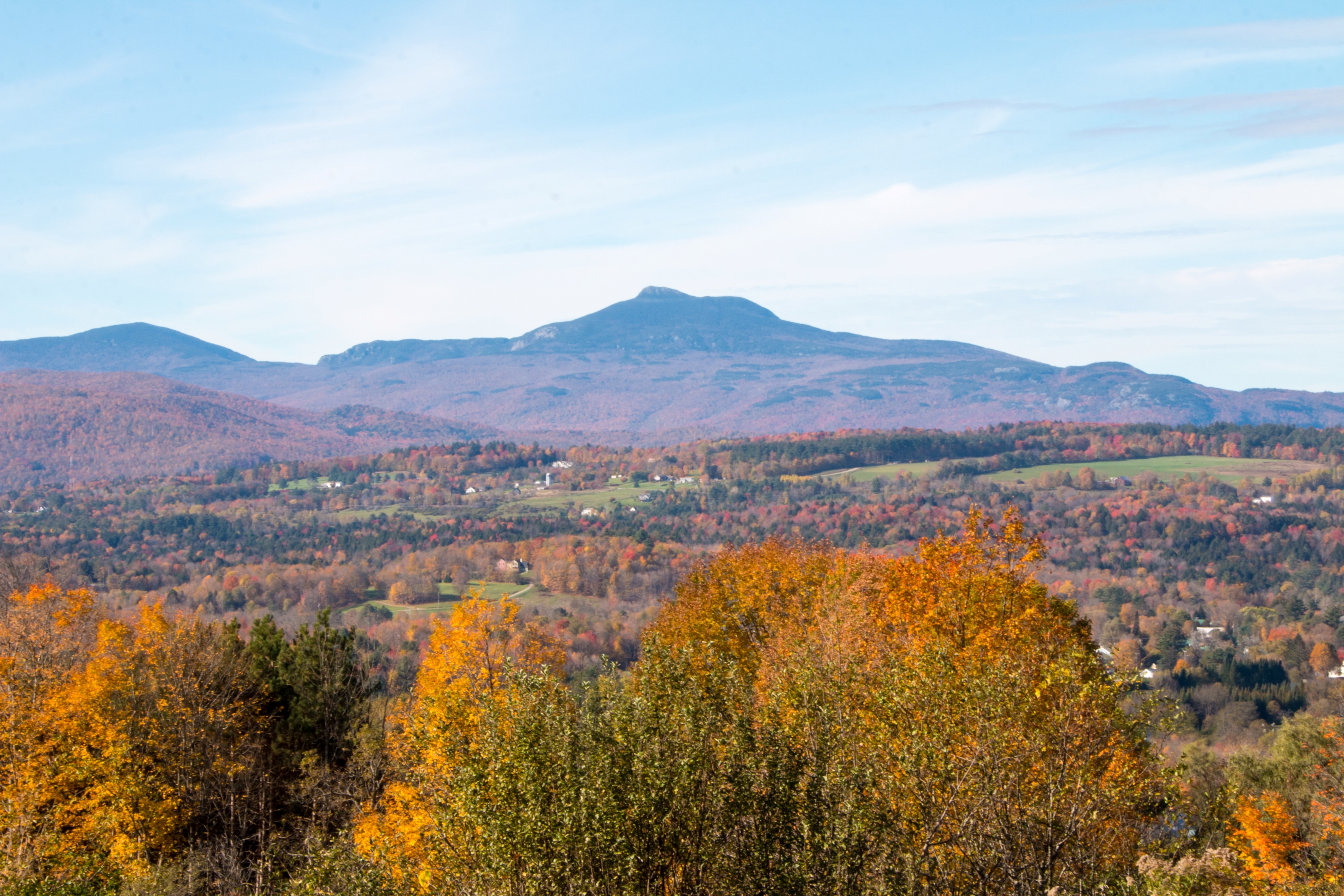
The scenic Green Mountain Byway starts in Waterbury and heads north along a picturesque loop through Stowe, Morristown, Cambridge, and other towns. The route also passes Mount Mansfield, Vermont's highest peak, and takes drives through the iconic Smugglers' Notch Road.
Distance: 18 miles
Estimated driving time: 1 hour
(Not recommended in midwinter, when road conditions may be hazardous)
Bear right onto VT Rt. 100S after crossing the bridge leading out of Waterbury. Turn right at the intersection with VT Rt. 100B and drive through Waitsfield, with good views of the hillsides, looking across working farms and fields of grazing cattle.
At the end of the village, bear right onto VT Rt. 17W, driving parallel to Mad River. Rt. 17 rises out of the Mad River Valley, and passes through the Appalachian Gap, along a winding road with multiple turnouts to enjoy beautiful overlooks of ponds and the valley.
Turn around at Gore Road as you reach Buel’s Gore, switch drivers (the driver will need to watch the road, not the scenery on the way out, due to many tight curves) and return to Waitsfield.
Distance: 11 miles
Estimated driving time: 30 minutes
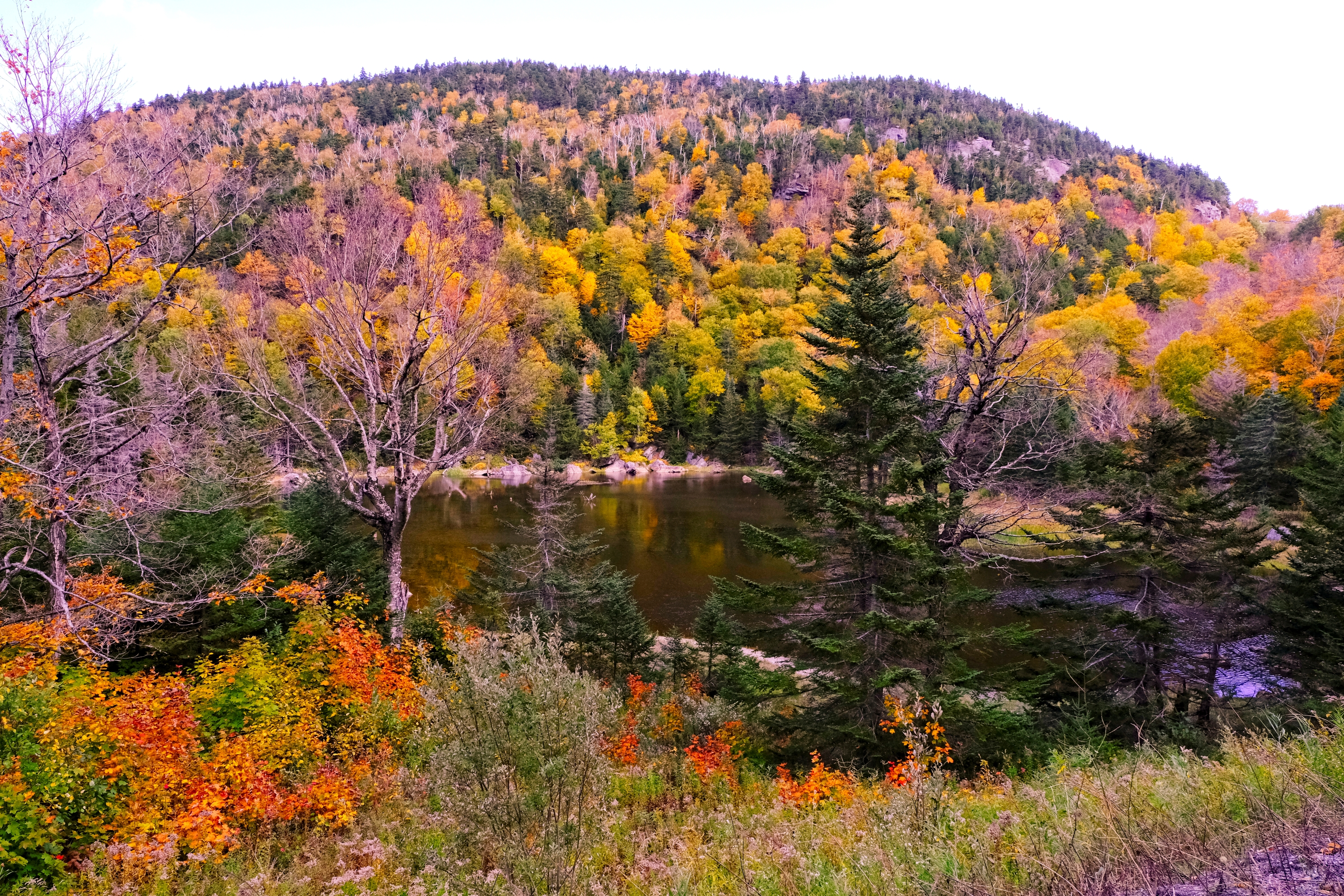
Start on River Road at the south end of downtown Waterbury and wind along the namesake Winooski River. Stop to take in the stream views, cast a fishing line, or cross the Winooski Street bridge and stroll along the Cross Vermont Trail, which parallels River Road north of the bridge.
Pull off at the Bolton Falls dam and enjoy a picnic at the small recreation area. For those interested in a different vantage point, follow the trails uphill to a rocky outcropping with a spectacular view of Camel’s Hump and the water below. This hike is just shy of a mile round trip and easy to moderate hike, but be cautious on the rocks at the top.
End the route at the Winooski River Footbridge, a 224-foot suspension bridge recently constructed by the Green Mountain Club to aid Long Trail hikers. The bridge is wheelchair accessible and offers great views of the river.
Distance: 4 miles
Estimated driving time: 15 minutes
This detour off Route 100 offers picturesque farm scenes and quaint pond views. Say hi to the cows, and keep an eye out for other wildlife, like turkeys, deer, and the occasional snapping turtle.
Stop at the turnout and take the easy to moderate hike to Elephant Rock, about one mile out and back. This beautiful vantage point of the Waterbury Reservoir is also a popular spot for boating or swimming, and has remote campsites nearby to extend the trip.
The drive pairs well with cider donuts from Cold Hollow Cider Mill, just south of Gregg Hill on Route 100, and coffee from Vermont Artisan Coffee & Tea, immediately past the turn. Or, if you’re looking for a full meal, the food and views at Michael’s on the Hill can’t be beat.
Distance: 4 miles
Estimated driving time: 15 minutes
The scenic trip along Guptil Road and Maple Street offers beautiful views for all to enjoy, but is a particular favorite of history and architecture enthusiasts. Along these roads are several buildings on Waterbury’s historic tour, including the Guptil Farmhouse, Minott House, and Green Mountain Seminary.
Make some tasty detours and stop at Hunger Mountain Orchard for pick-your-own apples or the Green Mountain Garlic farmstand for tomatoes, garlic, and other fresh goodies. Combine this route with the drive along Gregg Hill to add in some beautiful bodies of water, for an 8-mile trip that takes about 30 minutes to drive.
Hit the links and play 18 holes at the Center Chains Disc Golf course, just off Hope Davey Memorial Park, or the traditional golf course at Country Club of Vermont. Both are highly regarded within their fields.
Distance: 9 miles
Estimated driving time: 30 minutes
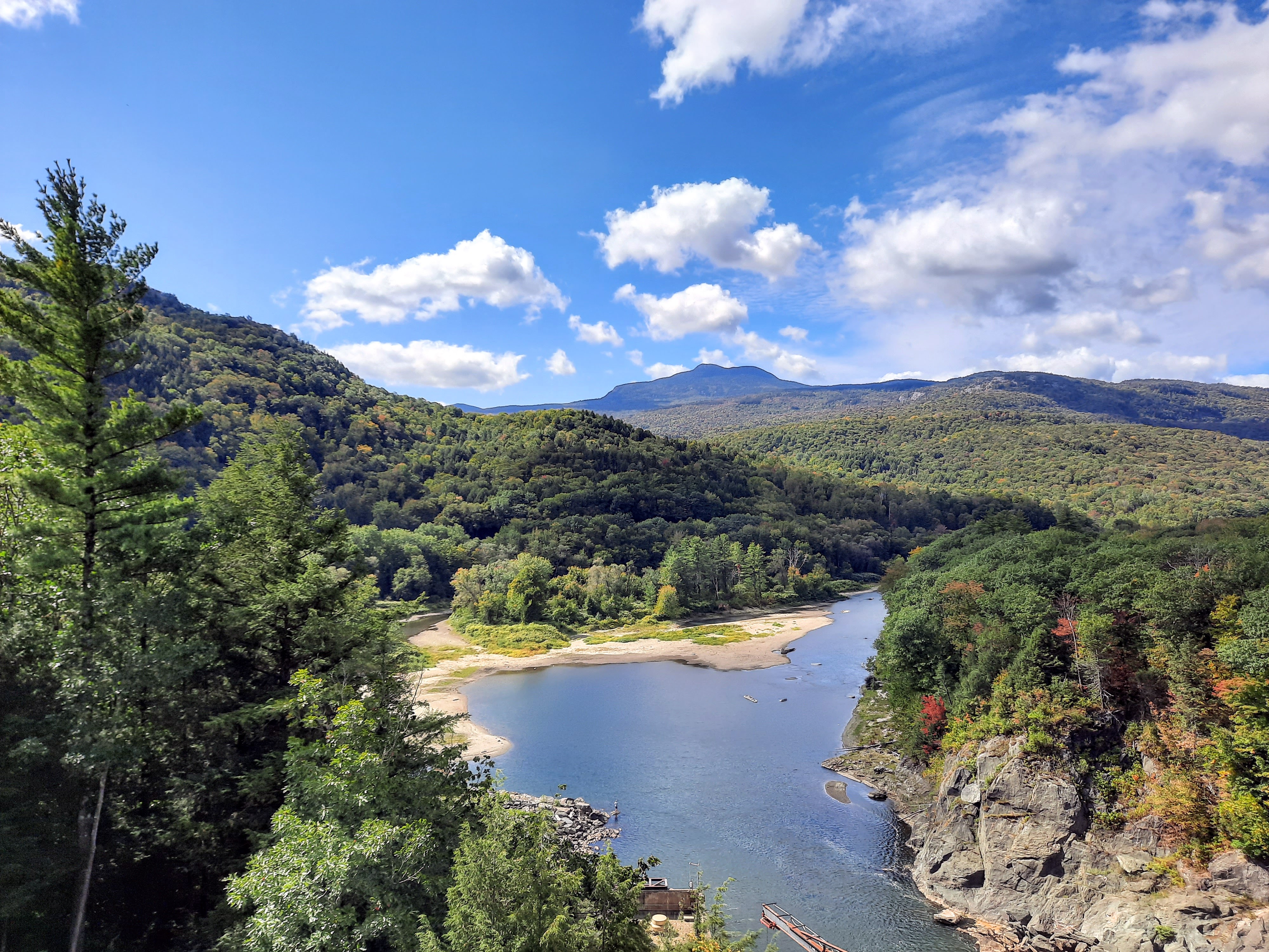
Turn onto Little River Road from VT Route 2W, 1.3 miles from the Waterbury Roundabout.
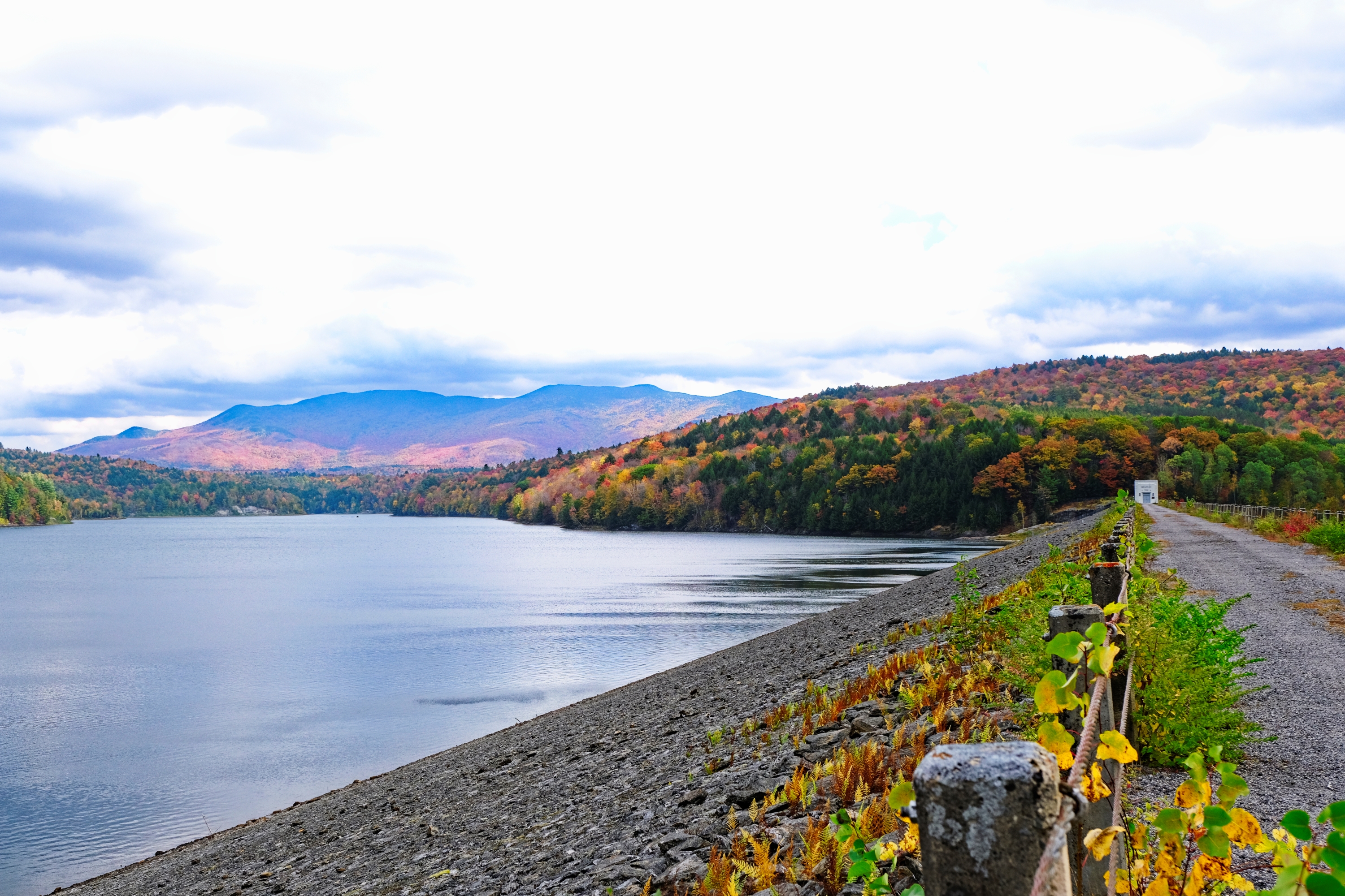
Pull off at 1.6 miles to see a small but dramatic gorge near the right side of the road. Continue just over a mile, park at the boat ramp and walk across the top of the Waterbury Dam. This earthworks dam was completed by the Civilian Conservation Corps and the Army Corps of Engineers in 1938, which created the Waterbury Reservoir. Enjoy an expansive view of the Green Mountains and the reservoir before continuing 3.6 miles on to the park entrance.
Pay a fee at the park entrance and continue through the park, pausing to enjoy one of the easy to moderate hikes or nature trails, before retracing your path to Route 2.
Distance: 7 miles
Estimated driving time: 20 minutes
Turn right onto Gold Brook Road off VT Rt 100N in Waterbury Center, then left onto Gold Brook Circle, driving parallel to the brook. At .8 miles, turn right onto Stowe Hollow Rd and enjoy broad views of the hillsides. Turn left onto Upper Hollow Road at the historic Grandview Farm barn and follow the gently winding road into a heavily wooded area, with occasional glimpses of Mt. Mansfield through clearings on your left.
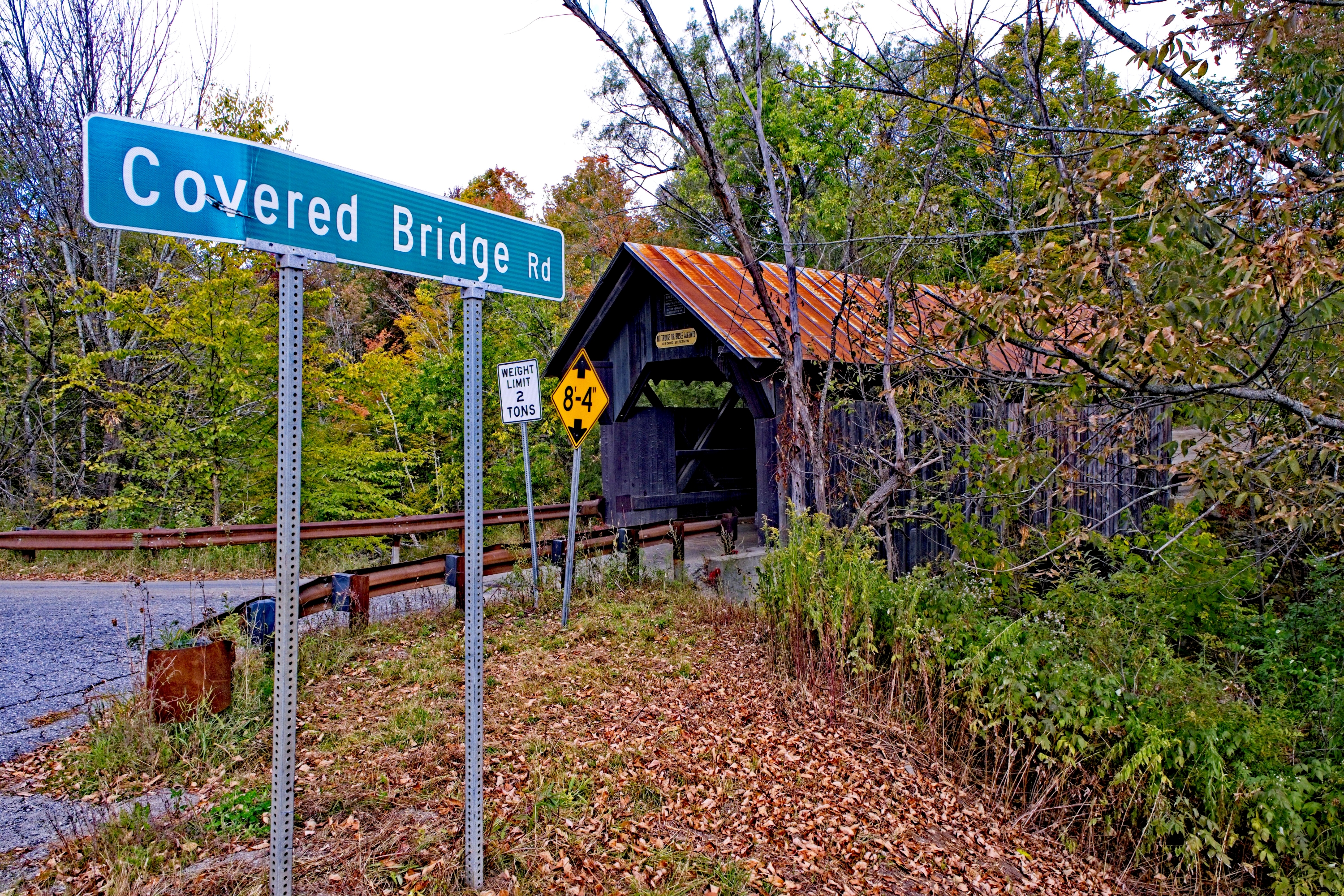
Turn left onto Covered Bridge Road, pausing at the pond on your left to stretch your legs or relax on one of the benches. Continue to Emily’s Bridge and read about its haunted history and avant garde construction (for its time) before crossing the brook and turning right onto Gold Brook Circle to return to VT Rt 100.
Distance: 5.4 miles
Estimated driving time: 15 minutes
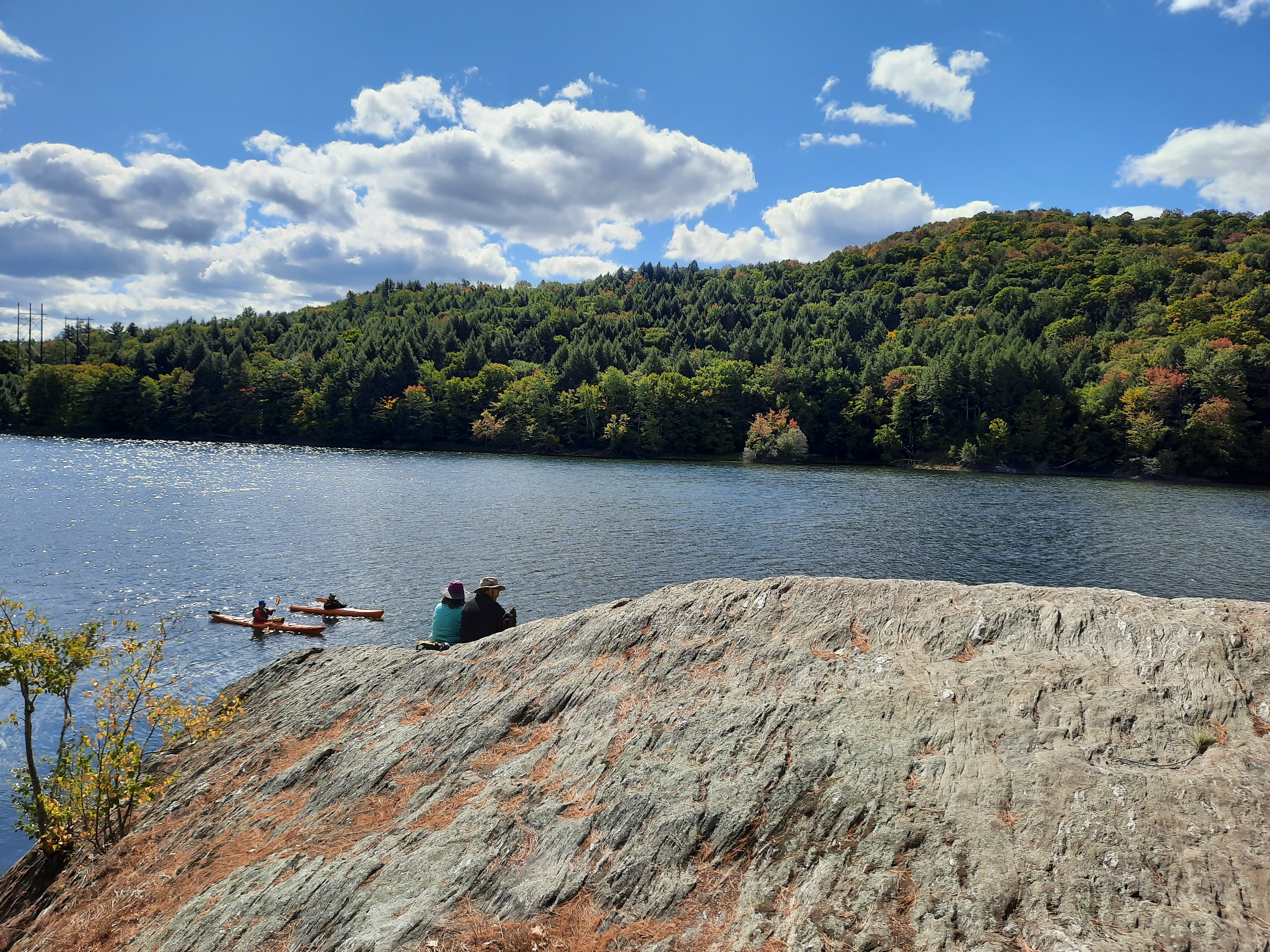
Start at the Best Western, just north of I-89 on VT Route 100N. Proceed up Blush Hill, catching glimpses of Camel's Hump off to you left through the clearings. Roadside development diminishes as you pass the golf course on your left and reach the silos of an abandoned farm. Look to the right for good views of Mt. Mansfield and watch for horses, cows, and llamas grazing in the fields to you right!
The road dead-ends at a boat ramp and turnaround, where you can see Mt. Mansfield and watch the boaters and stand-up paddlers playing on Waterbury Reservoir.
Distance: 15 miles
Estimated driving time: 25 minutes
I-89S is the conventional and fastest route to Waterbury from Burlington. For a more scenic and leisurely drive into town, access Rt 2 at the Richmond/Bolton exit 11.
