
Latest News
| Summer | 12 |
| Fall | 8 |
| Winter | 10 |
| Spring | 5 |
| Recreation | 12 |
| Arts & Culture | 11 |
| Food & Drink | 14 |
| Hiking | 7 |
| Shopping | 12 |
| History | 3 |
| Biking | 6 |
| August 2023 | 2 |
| June 2023 | 1 |
| September 2022 | 1 |
| July 2022 | 2 |
| May 2022 | 1 |
| February 2022 | 1 |
| November 2021 | 1 |
| June 2021 | 2 |
| April 2021 | 1 |
| February 2021 | 1 |
| December 2020 | 2 |
| November 2020 | 2 |
| September 2020 | 2 |
| August 2020 | 4 |
| Celebrate the Arts, Celebrating Waterbury at the Waterbury Arts Fest | Aug 18 2023 |
| Great Music Line Up at the Waterbury Arts Fest in August! | Aug 07 2023 |
| Save the Date for Great Summer Events! | Jun 16 2023 |
| Top 10 Local Favorite Outdoor Adventures in Central Vermont | Oct 06 2022 |
| Family-Friendly Fun in Waterbury | Jul 28 2022 |
| Quench Your Thirst in Central Vermont | Jul 25 2022 |
Hike the Best of Route 100
Vermont has always been known for its high-quality hiking trails and the Route 100 corridor between Waterbury, Stowe, and the Mad River Valley boasts some of the biggest and best peaks. With over 77 trails, there are plenty of offerings for hikers of all ages and abilities to explore the wide variety vistas, forests, lakes, streams, and waterfalls. Don't forget to take a break and discover the area's amazing restaurants, craft beverages, and small, independent shops.
waterbury
Nestled at the intersection of Interstate 89 and Route 100, Waterbury has easy access to a wide variety of hikes. From historic walks in the woods to climbs with 360-degree views, adventure starts here!
Little River State Park
The 4.8-mile Stevenson Brook Trail goes through the Little River State Park and connects to several other trails. Once the site of a thriving settlement, you’ll spot the evidence of hillside homesteads, sugarhouses, barns, sawmills and a cemetery, in the foundations, clearings and stone left behind. This is an easy to moderate hike for a half-day excursion.
Mount Hunger
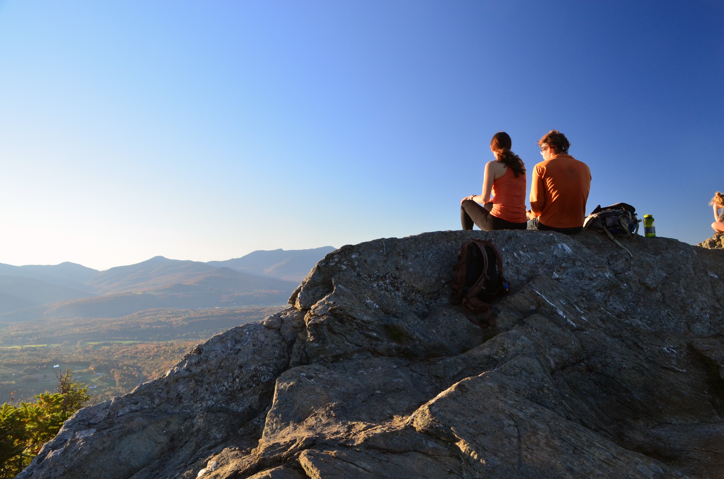
Approach central Vermont’s Mount Hunger from the west on the 4.4-mile Waterbury Trail. Cool off in the waterfall before you leave the woodland and get ready for an exhilarating rock scramble near the peak. At the top, you are rewarded with 360-degree views of Mount Mansfield, Waterbury Reservoir and Groton State Forest.
Camel’s Hump
Known for its distinct silhouette that some say resembles a couching lion, Vermont’s third highest peak offers breathtaking views of the Green Mountains and New York’s Adirondacks. Camel’s Hump is one of only three Vermont mountains with alpine tundra similar to growth from 1,000 miles to the north. The Monroe Trail winds up the eastern flank of the mountain. Look for the cemetery in which namesake Will Monroe is buried, and a plaque dedicated to the crew of a B-24 Liberator bomber which crashed there in mountain fog in 1944. This trail is more difficult at 6.8 miles long.
Stowe
With Stowe’s famous Green Mountain views, it is no secret that hiking is one of the most popular summertime activities. With a well-maintained trail system, stunning views and a variety of hikes for all skill-levels, a hike in Stowe is the way to go.
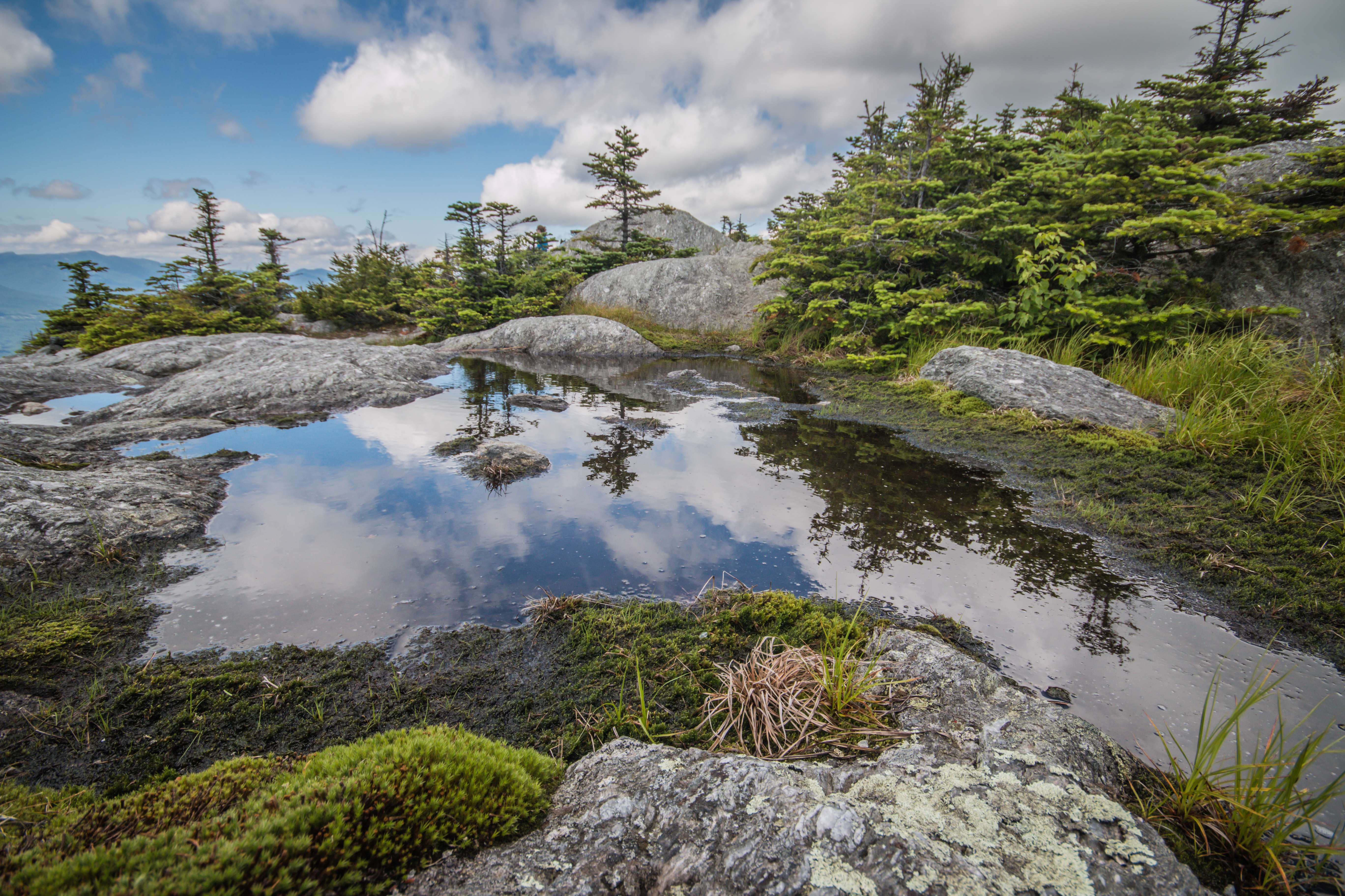
Sterling Pond
This gorgeous, moderate hike delivers you to the incredibly blue water of Vermont’s highest elevation trout pond. At 2.3 miles round trip, this is an excellent half-day hike to do with kids. Another intermediate option just outside of Stowe village is the Stowe Pinnacle, which offers great views of Mt. Mansfield and Camel’s Hump that are easily accessible after a short walk to a rock summit.
Stowe Pinnacle
The Stowe Pinnacle trail is wooded with a short, steady climb to a rock summit with views of Mt. Mansfield, Camel’s Hump, the Worcester Range and the Sterling Range. The hike is about three miles round-trip from the parking area on Upper Hollow Road, and a little shorter from the Pinnacle Meadows trailhead. The views at Stowe Pinnacle are phenomenal both in the summer and in the fall during foliage season.
Mt. Mansfield
One of the most challenging mountains to climb in Stowe and all of Vermont, Mt. Mansfield is the state’s highest peak. Though there are several ways to summit, Vermont’s historic Long Trail (LT) is one of the most popular. Built in 1910 by the Green Mountain Club, the LT is the United States’ oldest footpath and runs 273 miles between the Massachusetts and Canadian borders. Starting at the trailhead on VT Route 108, pass Taft Lodge, the oldest shelter on the LT, on your way to the Chin. Continue over the Chin and hang a left onto the Profanity Trail, which will loop back around for the rocky descent. It’s a long, rugged trip, so get an early start and bring plenty of food and water for the full 4.9-mile loop.

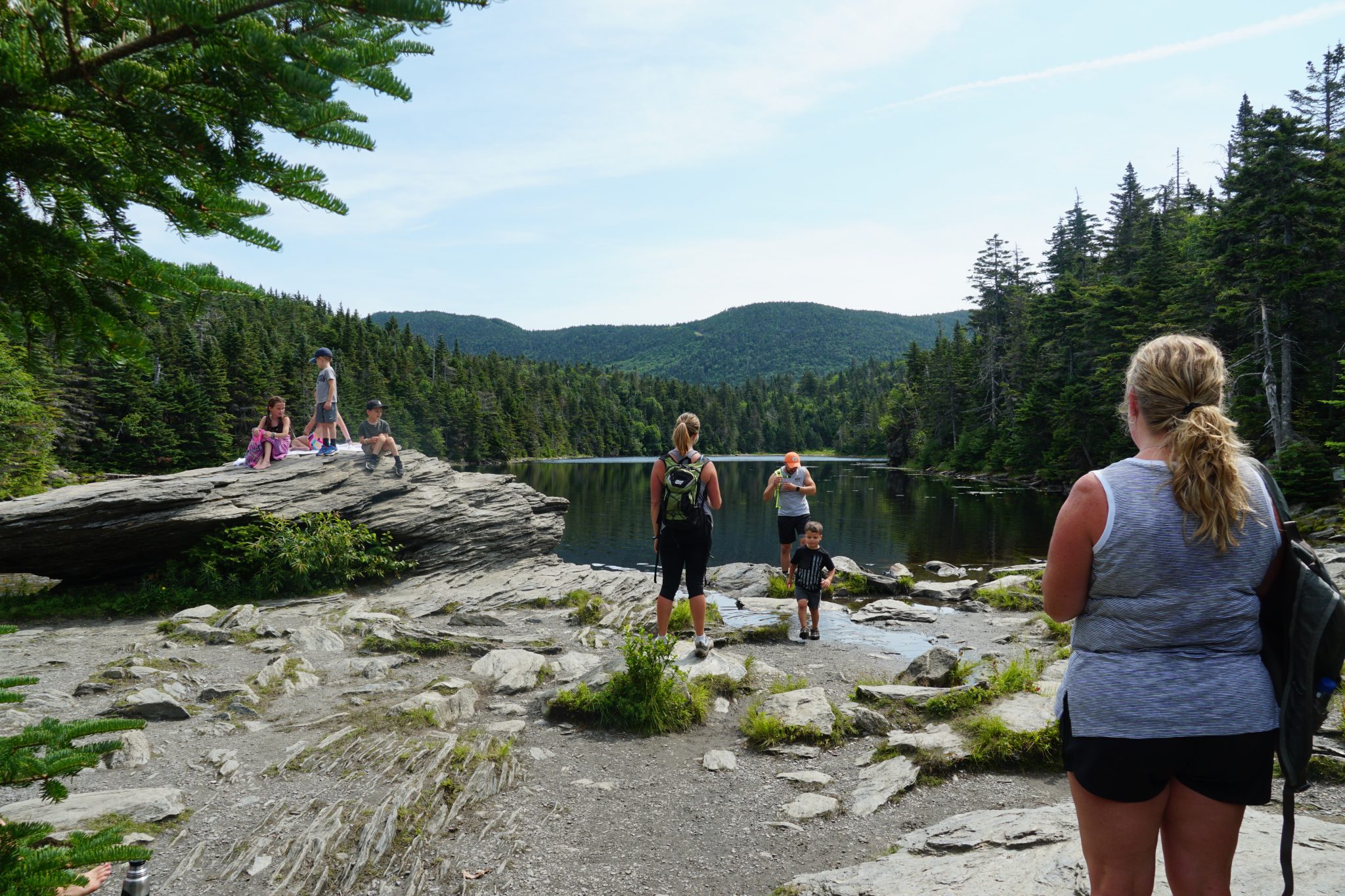
Mad River Valley
With scenic walks and rambles and full-day climbs, the Mad River Valley is home to a range of hikes for beginners and experts alike. As you explore the area trails, the valley’s love of the outdoors and commitment to stewardship of land and recreational opportunities for current and future generations will be evident.
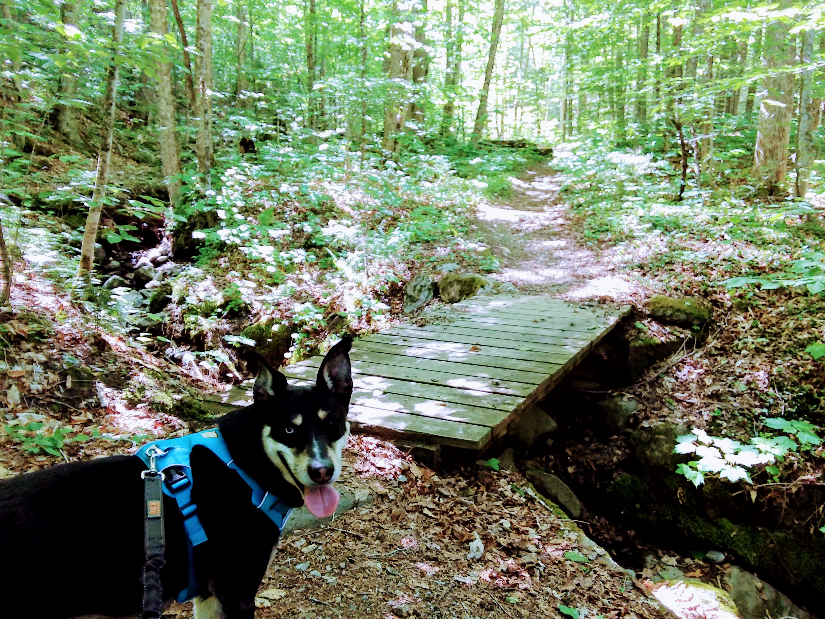
Mill Brook Path
For a more leisurely hike, the Mill Brook Path offers a journey through a hemlock forest and deer yard. This 3.9-mile hike includes moderately steep hills and wooden footbridges with a classic Vermont backdrop. The Mill Brook Path also connects to other local trails such as the Chase Brook Town Forest trails and the Catamount Trail for additional adventure.
Burnt Rock Mountain
Burnt Rock Mountain is a popular hiker’s destination in the Mad River Valley as it is known to have incredible views at the summit. Be ready to cross some streams and conquer a rock scramble during the 4.9-mile in-and-out hike.
Mt. Abraham
Mt. Abraham from Lincoln Gap is a more challenging hike; however, at more than 4,000 feet of elevation the views at the top are worth it. There is a 360-degree view from the summit that spans the Adirondacks, Lake Champlain and the White Mountains. This is a 5.7-mile round-trip hike that can take approximately four hours to complete.
Learn about the best of Route 100 in Vermont with more hiking in Waterbury, Stowe, and the Mad River Valley. Stop by the Green Mountain Club for expert hiking advice and learn about supporting their work to maintain trails and more.
Photos courtesy of: Discover Waterbury, Green Mountain Club, Go Stowe, and Mark Vandenberg/@stowebeautiful.